2 Jun 2026 09:05
Northeast River Forecast Center 2026
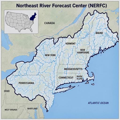
This is our 5th of five episodes with various River Forecast Centers of the United States. In the uppermost northeast corner of the US, the Northeast River Forecast Center is bound on three sides by water: the Great Lakes to the west, Canada's lakes and bays to the north, and the Atlantic Ocean to the east. The mountains of this region collect this moisture from various weather events and send that water down the river valleys. In this episode we talk with Bill Leatham, a Senior Hydrometeorologist with the Northeast River Forecast Center. This landscape is impacted by its regional waterscape, the hurricanes in the Southeast and even the weather patterns of El Niño and La Niña. What winter weather did they receive? When did their snow melt? Are they experiencing a drought? What type of storms do they expect this summer?
GUEST Bill Leatham, Senior Hydrometeorologist Northeast River Forecast Center
NOAA National Oceanic and Atmospheric Administration
SPONSORSPoudre River Fund
PREVIOUS EPISODES ON RIVER FLOW FORECAST
Southeast River Forecast Center 2026 - Apple Podcasts
Southeast River Forecast Center 2026 - Spotify
Colorado River Basin Snowpack & River Flow 2026 - Apple Podcasts
Colorado River Basin Snowpack & River Flow 2026 - SpotifyCalifornia & Nevada Snowpack & River Flow 2026 - Apple Podcasts
California & Nevada Snowpack & River Flow 2026 - Spotify
Columbia Basin Snowpack & River Flow 2026 - Apple Podcasts
Columbia Basin Snowpack & River Flow 2026 - Spotify2024 Snowpack & River Flow - Apple Podcasts